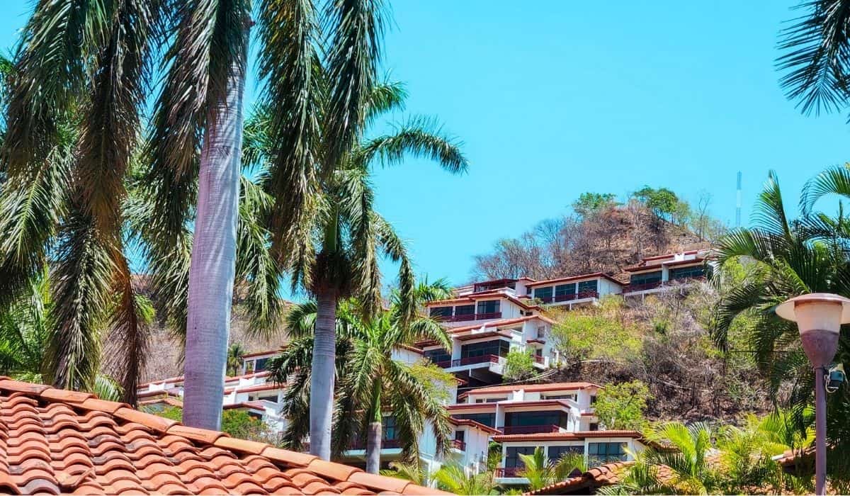
A Costa Rica map is the easiest way to see how this small country fits together, from the Pacific and Caribbean coasts to the volcanoes and cloud forests in between.
We are Sarah and Thomas, a couple from the US and Germany who have called Costa Rica home for the past 10 years, and we have used maps like these to plan more road trips than we can count.
This guide shows where Costa Rica is, what each of the seven regions is like, which airport to fly into, and where to find beaches, national parks, volcanoes and resorts on the map.

Where Is Costa Rica on the Map?
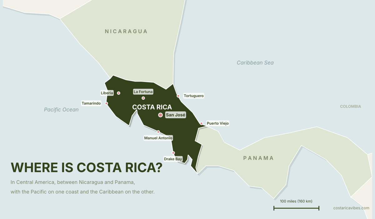
Costa Rica is in Central America, on the narrow land bridge that connects North and South America. Nicaragua is to the north and Panama is to the south, with the Pacific Ocean on the west coast and the Caribbean Sea on the east.
It sits between 8° and 11° north of the equator, so the climate is tropical all year. The country is also small, so you can start your morning with a sunrise over the Caribbean Sea and end the day with a sunset over the Pacific Ocean.
| Quick facts | Details |
|---|---|
| Location | Central America, between Nicaragua (north) and Panama (south) |
| Coastlines | Pacific Ocean (west) and Caribbean Sea (east) |
| Size | 19,710 square miles (51,060 km²) |
| Coast to coast | About 4 hours by car |
| Capital | San José |
| Main airports | Juan Santamaría (SJO) near San José and Daniel Oduber Quirós (LIR) in Liberia |
| Language | Spanish |
| Currency | Costa Rican colón (CRC), though US dollars are widely accepted |
| Time zone | Central Standard Time (UTC -6) all year |
How Far Is Costa Rica From Major Cities?
- From New York, about a 5-hour flight and 2,200 miles (3,540 km)
- From Miami, about a 2.5-hour flight and 1,100 miles (1,770 km)
- From Los Angeles, about a 6-hour flight and 2,700 miles (4,345 km)
- From Madrid, about an 11-hour flight and 5,300 miles (8,500 km)
Looking for flights? Read our guide to flights to Costa Rica →
Costa Rica Regions Map

Costa Rica is divided into seven main regions, each offering unique landscapes, climates, and experiences. Here’s a quick breakdown to help you decide where to go.
| Region | Best for | Top destinations |
|---|---|---|
| San José & the Central Valley | City life, volcanoes, coffee farms, cultural experiences | San José, Alajuela, Cartago, San Gerardo de Dota |
| The Central Pacific Coast | Beaches, surfing, national parks, and adventure | Jaco, Manuel Antonio, Quepos, Esterillos, Herradura |
| The South Pacific (Osa Peninsula) | Wildlife, jungle, remote beaches, adventure | Uvita, Dominical, Puerto Jiménez, Drake Bay |
| The Caribbean Coast | Relaxed atmosphere, turquoise waters, wildlife, Afro-Caribbean culture | Puerto Viejo, Cahuita, Manzanillo, Tortuguero |
| The Nicoya Peninsula | Surfing, yoga, off-the-beaten-path beach towns | Santa Teresa, Montezuma, Nosara, Samara |
| Guanacaste (Northwest Costa Rica) | Luxury resorts, snorkeling, volcanoes, dry tropical climate | Tamarindo, Papagayo, Flamingo, Playa Hermosa |
| The Northern Mountains (Arenal & Monteverde) | Adventure, hot springs, cloud forests, volcano views | La Fortuna, Monteverde |
San José & the Central Valley
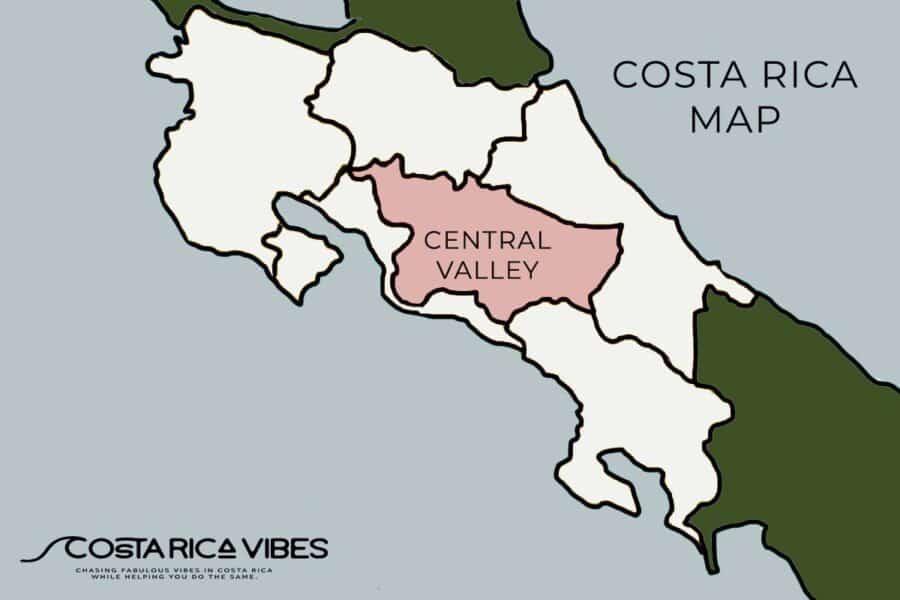
This area is home to beautiful views, dormant and active volcanoes, the major international airport, plenty of coffee farms, and most of the major cities in the country.
- Best for: City life, volcanoes, coffee farms, cultural experiences
- Top Destinations: San José, Alajuela, Cartago, San Gerardo de Dota
- Must-Do: Visit Poás Volcano, Irazú Volcano, and coffee farms
Check out our Central Valley guide for more info →
Where Is the Capital of Costa Rica?

The capital of Costa Rica is San José. This city is located in the heart of the country in the Central Valley region.
It serves as the main economic, cultural, and transportation hub of Costa Rica.
Check Out Our Guide to San Jose for More Info
The Central Pacific Coast

- Best for: Beaches, surfing, national parks, and adventure
- Top Destinations: Jaco, Manuel Antonio, Quepos, Esterillos, Herradura
- Must-Do: Visit Manuel Antonio National Park and go surfing in Jaco
Check out our Central Pacific guide for more info →
The South Pacific (Osa Peninsula)

- Best for: Wildlife, jungle, remote beaches, adventure
- Top Destinations: Uvita, Dominical, Puerto Jiménez, Drake Bay
- Must-Do: Walk the Whale’s Tail sandbar at Marino Ballena National Park in Uvita and explore Corcovado National Park
Check out our South Pacific guide for more info →
The Caribbean Coast
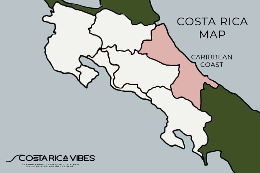
This side of the country has a completely different vibe than the Pacific coast.
Here you can expect a Caribbean vibe, turquoise waters and many darker sand beaches.
- Best for: Relaxed atmosphere, turquoise waters, wildlife, Afro-Caribbean culture
- Top Destinations: Puerto Viejo, Cahuita, Manzanillo, Tortuguero
- Must-Do: See sea turtles in Tortuguero and snorkel in Cahuita National Park
Check out our Caribbean guide for more info →
The Nicoya Peninsula
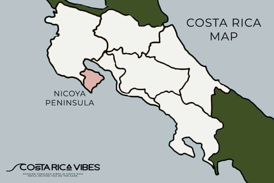
This remote little corner of the country is filled with beautiful beaches, world-class surf, fishing, and great hiking spots.
It is not the easiest to get to this region, but that contributes to its charm.
- Best for: Surfing, yoga, off-the-beaten-path beach towns
- Top Destinations: Santa Teresa, Montezuma, Nosara, Samara
- Must-Do: Try yoga and surfing in Nosara, and hike to the waterfalls in Montezuma
Check out our Nicoya Peninsula guide for more info →
Guanacaste (Northwest Costa Rica)

This area near the Nicaragua border is home to the city of Liberia, one of the country’s two international airports, several nice beach towns, volcanoes, and waterfalls.
- Best for: Luxury resorts, snorkeling, volcanoes, dry tropical climate
- Top Destinations: Tamarindo, Papagayo, Flamingo, Playa Hermosa
- Must-Do: Stay at an all-inclusive resort in Papagayo and visit Rincón de la Vieja volcano
Check out our Guanacaste guide for more info →
The Northern Mountains (Arenal & Monteverde)

- Best for: Adventure, hot springs, cloud forests, volcano views
- Top Destinations: La Fortuna, Monteverde
- Must-Do: Hike Arenal Volcano, soak in hot springs, and zipline in Monteverde
Check out our Northern Mountains guide for more info →
Costa Rica Beach Map
Want to explore on your own? Open this map in Google Maps →
Costa Rica has over 800 miles (1,290 km) of coastline with stunning beaches on both the Pacific and Caribbean coasts.
Sarah’s Tip: Keep in mind that by law all beaches in Costa Rica need to be free to enter and have access to the public.
This map shows some of our absolute favorite beaches in the country. Some places are great for surfing, some for swimming, and some for relaxing.
For more beach tips, check out our Costa Rica beach guide.
Costa Rica Map of National Parks
Want to explore on your own? Open this map in Google Maps →
Costa Rica has 30 national parks located throughout the country which encompasses 25% of the land in the country.
These national parks consist of volcanoes, sea turtle breeding grounds, areas of dense wildlife, waterfalls, and more.
Click on the map above to find out more about the national parks in the area you are visiting.
We also have a guide to national parks to give you more info.
Costa Rica Volcano Map
Want to explore on your own? Open this map in Google Maps →
Costa Rica is filled with impressive active and dormant volcanoes.
For our favorite volcano pictures, head to Arenal Volcano in La Fortuna.
For active volcanoes in which you can see the crater up close, we suggest Poas or Irazu in the Central Valley region.
Want to see one up close? Read our Costa Rica volcanoes guide →
Map of Costa Rican Resorts
Want to explore on your own? Open this map in Google Maps →
If you’re looking for an all-inclusive resort experience, Costa Rica has plenty of options.
We included our favorite 15 places throughout the country in this map.
For more options check out our guide to Costa Rice resorts.
More Costa Rica Maps
Costa Rica Waterfalls Map
Want to explore on your own? Open this map in Google Maps →
This waterfall map of Costa Rica includes the most popular falls to visit.
Keep in mind that sometimes you will get lucky and find waterfalls on private properties or in other parks throughout the country.
For more information check out our waterfall guide.
Costa Rica Golf Courses Map
Want to explore on your own? Open this map in Google Maps →
If golfing is your thing, here is a map of all the major golf courses in the country. Keep in mind that some of these are located in private resorts and may not be open to non-guests.
You can find out more with our guide to golfing.
Which Airport Should You Fly Into?

Costa Rica has two main international airports, plus several domestic airports that make getting around easier.
- Flying into SJO? Best for trips to Manuel Antonio, the Caribbean, or the Southern Pacific.
- Flying into LIR? Best for Tamarindo, Papagayo, and Nicoya Peninsula destinations.
- If you want to visit the jungle towns of La Fortuna or Monteverde, both places are easily accessible from either international airport.
Check out our full Costa Rica Airports Guide →
For flights, we suggest checking out Skyscanner. We consistently find good deals and flight options there.
Domestic Airports in Costa Rica
Want to explore on your own? Open this map in Google Maps →
Flying within Costa Rica? Several domestic airports make it easy to reach remote destinations.
Popular ones include Tambor (TMU), Drake Bay (DRK), Tortuguero (TTQ) and Quepos (XQP).
Find Out More in Our Guide to Domestic Airports
How to Use Costa Rica Maps to Get Around
When planning your trip to Costa Rica, you will need to use digital maps to get around.
Google Maps vs. Waze
- Google Maps: Best for estimating driving times and exploring locations before your trip. Google Maps is also easy to download offline in case you lose cell phone service.
- Waze (Recommended): The most reliable navigation app in Costa Rica. It updates in real time and is widely used by people here. We love Waze because people here are great about marking things like police or road work on the map. This is so helpful when driving.
- Paper Maps? Not Recommended. Roads are constantly changing, and digital maps provide the most up-to-date directions.
Sarah’s Tip: Always add an extra hour to your estimated travel time, especially for long drives in remote areas! It is not unusual to get stuck behind a big truck and have difficulty passing on narrow stretches of road.
Planning to drive? Read our driving in Costa Rica guide and our guide to renting a car in Costa Rica →
Not comfortable driving long distances? Compare shuttles and transfers or see shuttle vs. rental car →
Crossing Costa Rica’s Land Borders

Costa Rica shares land borders with Nicaragua to the north and Panama to the south.
The two easiest places to cross the border are in Sixaola (if heading to Panama) and in Penas Blancas (if heading to Nicaragua).
For more information, we suggest checking our guide to the Nicaragua border and our guide to the Panama border crossing.
Frequently Asked Questions
Where is Costa Rica on the world map?
On a world map, Costa Rica is the country directly north of Panama and south of Nicaragua. It is located in Central America and has an extensive Pacific and Caribbean coast.
Does Google Maps work in Costa Rica?
Yes, Google Maps is great for driving directions within Costa Rica. However, the preferred GPS app for most people in Costa Rica is Waze.
What side of Costa Rica is nicer?
That depends on your preference. The Pacific coast is more popular with tourists and is known for having nicer beaches. But, the Caribbean coast has a more raw authentic feel.
Is Costa Rica an island?
No, Costa Rica is not an island. The country is located in Central America and has land borders with Nicaragua and Panama.
How big is Costa Rica?
Costa Rica covers about 19,710 square miles (51,060 km²). It is small enough that you can drive from the Caribbean coast to the Pacific coast in about 4 hours, though we always add an extra hour for traffic and slow trucks.
Which airport is better to fly into, SJO or LIR?
It depends on where you are headed. SJO near San José is closer to Manuel Antonio, the Central Valley and the Caribbean, while LIR in Liberia is closer to the Guanacaste beaches.
If you have questions about Costa Rica maps, drop them in the comments below. We are always happy to help.
Next step in your planning Choose where to stay →
You might also be interested in:
- Costa Rica Airports: Which Is Better, San Jose or Liberia?
- Costa Rica Domestic Airlines – Find a Flight
- Costa Rica Shuttle Guide: Everything You Need to Know About Shared and Private Transportation
- Costa Rica and Panama Border Crossing: How to Get Across Without the Stress
- Costa Rica Nicaragua Border Crossing: A Complete Guide to Peñas Blancas
Travel easier
Plan Smarter, Travel Easier
Before you go, here are the tools we use for every Costa Rica trip.
Need help planning? Try our free day-by-day trip planner, grab our 7-day itinerary for first-timers, or join our email list and we will walk you through it step by step.

Meet the writer
Sarah McArthur
Sarah is the co-founder and main writer of Costa Rica Vibes. Originally from the US, she has lived in San José, Costa Rica since 2016 with her husband Thomas, who takes the photos you see on this site.
Together they have been writing about Costa Rica since 2017, drawing on years of road trips, hotel stays and tours around the country. We personally vet everything before we publish it.
Follow along on Instagram · Pinterest · Substack
or join our email list for trip planning help.